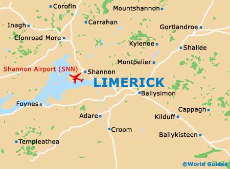
Limerick Maps and Orientation
(Limerick, County Limerick, Republic of Ireland)
County Limerick is a swathe of farmland on lowlands fed by the River Shannon. The city of Limerick lies on the western border of the county and straddles the river estuary at the same spot where Viking raiders established an early settlement in the 9th century. Before that time, locals lived on farmsteads in less consolidated villages. Woodcock Hill lies to the north of the city, with the Silvermine Mountains to the east.
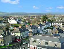
Tourists can buy maps to make sense of the city layout. Rutland Street runs north to south through central Limerick, but its name changes along the way. The oldest part of the city is to the north in an area called King's Island, the former epicenter of the old English town and host to some of the most impressive architecture in Limerick. To the south are Pery Square and Crescent Square, two areas containing dozens of elegant Georgian houses.
Maps and Orientation of the City
Finding your way around downtown Limerick is easy enough, especially if you have a bicycle or a good pair of shoes and an open schedule. On the other hand, navigating the countryside requires more careful planning. You'll want to pick up a map with major motorways and back roads clearly marked so that you can reach remote sites like Lough Gur.
Maps are available online, and these are best suited for planning an upcoming trip to Limerick, as they will help you understand the city's orientation in relation to its neighbouring communities. Once in Limerick, you can most likely pick up or purchase a map from your hotel's front desk. If you are planning on hiring a car, your chosen rental company can set you up with a detailed map of the county.
- Adare - 19 km / 12 miles (20 minutes, south-west)
- Clare - 45 km / 28 miles (40 minutes, north-west)
- Cork - 100 km / 62 miles (one hour and 30 minutes, south)
- Ennis - 36 km / 22 miles (30 minutes, north-west)
- Galway - 100 km / 62 miles (one hour and 30 minutes, north-west)
- Kilkee - 90 km / 56 miles (one hour and 20 minutes, west)
- Killarney - 110 km / 68 miles (one hour and 40 minutes, south-west)
- Lough Gur - 25 km / 16 miles (30 minutes, south-east)
- Newcastlewest - 43 km / 27 miles (40 minutes, south-west)
- Patrickswell - 12 km / 7 miles (20 minutes, south-west)
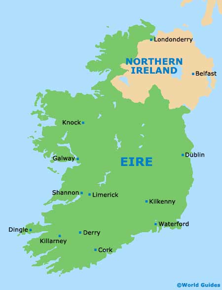
Map of the United Kingdom

Map of Ireland
Map of Limerick