Reykjavik Maps and Orientation
(Reykjavik, Capital Area, Iceland)
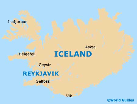
Iceland's biggest and most significant city, Reykjavik has long been the Icelandic capital. Reykjavik is located on the south-west side of Iceland, directly south of the Arctic Circle and alongside the scenic Faxaflói Bay, where a series of coves, islands and peninsulas are to be found. The city has grown to become an important centre of economy and politics, and now boasts a population exceeding 120,000 people.
Reykjavik is a particularly historic city and is thought to have first been settled at the end of the 9th century, being official founded in the late 18th century. It was at this time that notable urban development began and the Reykjavik of today was born.
Maps and Orientation of the City
Although much of the appeal lies within the city centre, the Greater Reykjavik Area is also of interest and is in fact the only Icelandic metropolitan region. This area boasts a population of around 200,000 and is best explored by using a map.
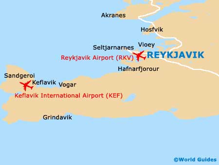
Within central Reykjavik, there are six distinct municipalities, the most significant of which are Hafnarfjöröur and also Kópavogur. Hafnarfjöröur is an attractive port town sited directly south-west of Reykjavik and famous for its summer solstice and viking festival, while Kópavogur can be found to the south and is home to Iceland's tallest building, the Smáratorg Tower.
- Akranes - north
- Garoabaer - south
- Garour - west
- Grimsstaoaholt - west
- Grindavik - south-west
- Hafnarfjöröur - south-west
- Hafnir - west
- Hosfvik - north
- Keflavik - west
- Kópavogur - south
- Mosfellsbaer - north-east
- Oskjuhlio - west
- Porlákshöfn - south
- Seltjarnarnes - north-west
- Vioey - north
Map of Iceland
Map of Reykjavik