Crete Maps and Orientation
(Crete, Greece)
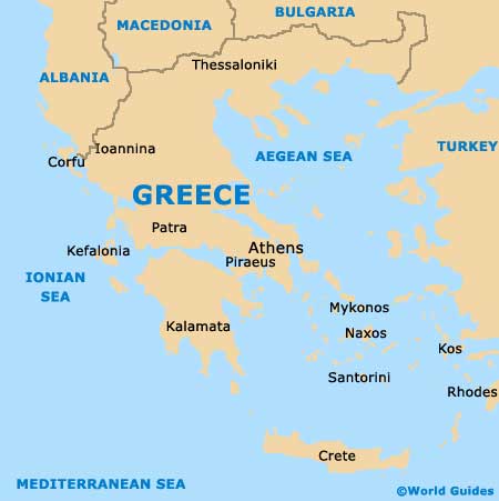
The island of Crete is so large that it really does resemble more of a small country than a big island, with an overall population exceeding half a million islanders. This largest of all the islands within Greece, Crete is a very southerly island and is actually only 300 km / 186 miles from the coastline of Africa.
Stretching some 250 km / 155 miles in length, Crete is around 60 km / 37 miles at its very widest point, and just 12 km / 7 miles where it is at its narrowist. The rather rugged landscape forming the island's interior region comprises three main mountain ranges, the westerly White Mountains (Lefka Ori), the centrally located Mount Idi (Mount Psiloritis) and also the easterly Lasithi Mountains.
Maps and Orientation of the Island
The island's Iraklio region marks the main entry point for the majority of visiting tourists and this is a very busy area, particularly during the summer season. Iraklio successfully combines both Minoan archeology (including the ruins of Knossos) and tourism, and here, Heraklion is not only the capital of Crete, but also the fifth-largest city in the whole of Greece, with a population of around 135,000 people. The two other main regions / prefectures on Crete are Rethymno (west) and Lasithi (east).
Other significant parts of Crete are as follows:
- Agios Nikolaos
- Chania (Hania - second-largest city)
- Elounda
- Chersonissos
- Ierapetra
- Paleochora
- Rethimno (capital of Rethymno)
- Sfakia
- Sitia
- Zakros
Map of Greece
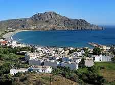
Map of Crete

