Hanoi Maps and Orientation
(Hanoi, Vietnam)
Located on the northern side of
Vietnam, Hanoi serves as the Vietnamese capital, although it not actually the largest city in the country - Ho Chi Minh City has earned that particular title. Hanoi lies on the right-hand side of the Song Hong (Red River) and is often described as being an appealing blend of 'East meets West', with both an oriental and colonial past.
Two bridges span the Red River. The historic Long Bien Bridge dates back to 1903 and currently only used by trails, moped and bicycles, as well as pedestrians. Close by and to the south, the more recently built Chuong Duong Bridge is much more modern in design and sees much traffic on a daily basis.
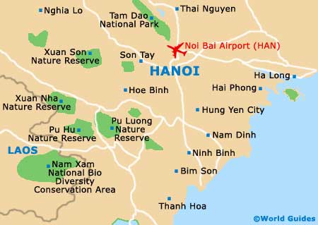
Maps and Orientation of the City
The very heart of the city has grown up around the Hoan Kiem Lake and is steeped in history. Head just a short distance to the north and you will soon discover the Old Quarter, where many tourists choose to base themselves, due to its colourful character and vibrancy. The Old Quarter is full of narrow lanes, short streets and old buildings.
The ancient Hanoi Citadel is located on the westerly side of the Old Quarter and is a particularly attractive sight, although is now sadly closed to members of the general public. To the west is
Ho Chi Minh's Mausoleum, as well as a series of grand foreign embassies boasting French-influenced architecture.
Maps of Hanoi are available in all sizes, being available to purchase at most bookstores. If you are intending to use bus transport during your stay, then bus maps (Xe Buyt Ha Noi) are essential.
- Ba Vi National Park - 70 km / 43 miles (one hour and 15 minutes, west)
- Bat Trang - 18 km / 11 miles (30 minutes, south)
- Cam Pha - 183 km / 114 miles (three hours and 15 minutes, east)
- Dong Dang - 162 km / 101 miles (three hours, north-east)
- Hai Phong - 125 km / 78 miles (two hours, east)
- Halong Bay - 144 km / 89 miles (two hours and 30 minutes, east)
- Hoa Binh - 98 km / 61 miles (one hour and 40 minutes to the south-west)
- Lang Son - 148 km / 92 miles (two hours and 30 minutes, north-east)
- Nam Dinh - 92 km / 57 miles (one hour and 40 minutes, south)
- Sapa - 325 km / 202 miles (five hours, north-west)
- Thai Nguyen - 75 km / 47 miles (one hour and 25 minutes, north)
- Thanh Hoa - 158 km / 98 miles (two hours and 50 minutes, south)
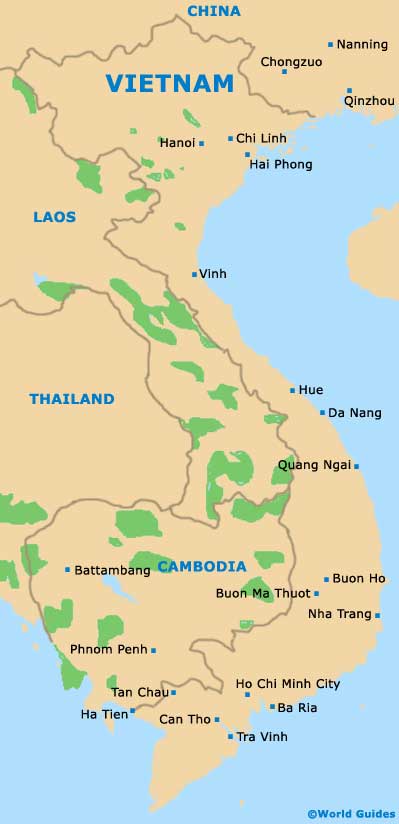
Map of Vietnam
Map of Hanoi