Varanasi Maps and Orientation
(Varanasi, Uttar Pradesh, India)
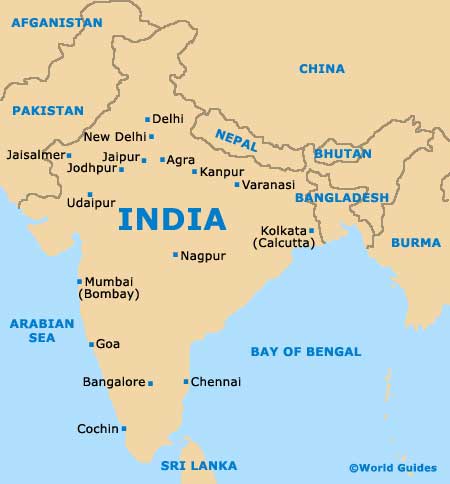
A city of huge proportions located on the western banks of the River Ganga (Ganges), more than one million residents currently call Varanasi their home. The city of Varanasi lies within North India's Uttar Pradesh state, in the very heart of the Ganga Valley, and remains amongst the world's oldest cities, being continuously occupied for literally thousands of years.
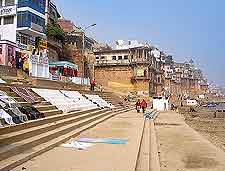
Serving as the headquarters for the regional Varanasi District, the city centre is based around the banks of the River Ganga and can become rather crowded, with narrow streets and lanes lined with busy shops and historical Hindu temples. The outskirts of the city tend to be more spacious and spreading, although for many, this rather frenetic Indian lifestyle is what gives the city centre its character.
Maps and Orientation of the City
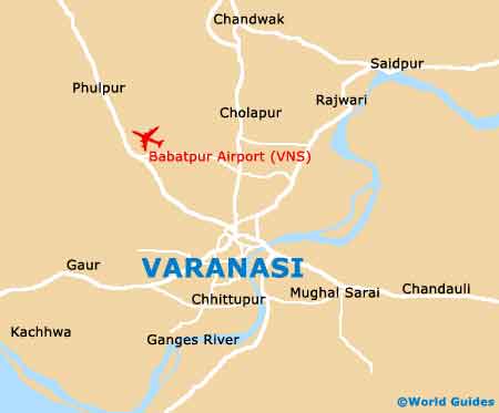
Varanasi's Old City area is located on the western banks of the Ganga and extended away from the riverbanks, into a maze of pedestrianised back streets known as the 'Galis'. Many tourists find that the streets of the Galis can be somewhat confusing, although most hotels tend to be signposted and relatively easy to find.
Visitors regularly choose to stay in the less-crowded areas of Lahurabir or the Cantonment, which lie on the southern and northern sides of the railway station, respectively. Varanasi maps are available at a number of bookshops around the city centre, around street such as Dasaswamedh Ghat Road, Luxa Road and Mandapur Road. Further afield are the following cities, towns and village destinations.
- Agra - north-west
- Allahabad - west
- Aurangabad - south-east
- Azamgarh - north
- Barabanki - north-west
- Etawah - north-west
- Gaya - east
- Ghazipur - east
- Gorakhpur - north
- Kanpur - north-west
- Lucknow - north-west
- Muzaffarpur - north-east
- Patna - east
- Ranchi - south-east
Map of India
Map of Varanasi