Jaisalmer Maps and Orientation
(Jaisalmer, Rajasthan, India)
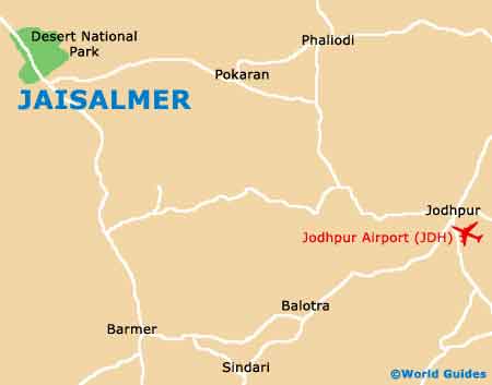
Located on the far western side India's vast Rajasthan state, the city of Jaisalmer is extremely close to Pakistan's border, which lies of the northerly and westerly sides. Directly to the north of Jaisalmer is the Desert National Park, while to the east and the south, the Highway NH 15 connects the main places of interest.
Jaisalmer is a very sandy city, with a low annual rainfall. There is one relatively small river flowing through the city itself and this is named as 'Kakni'. The Kakni River meanders for almost 30 miles / 48 km, before becoming the Bhuj-Jhil Lake.
Maps and Orientation of the City
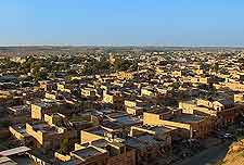
High above the city itself, Jaisalmer Fort dominates the area and is visible for quite literally miles, being a famous and iconic symbol. The fort itself can be entered from the First Fort Gate, when you will immediately discover a maze of narrow, paved alleyways, together with temples and a historic palace.
Maps of Jaisalmer are available at the number of outlets, including the ever-popular outlet of the Tourist Reception Centre, which is just a stone's throw to the south-east of the fort, on the Gadi Sagar Road. Maps can also be found at the Bhatia News Agency at the city's bustling Bhatia Market, and here you can also purchase day-old newspapers in a variety of different languages.
The following destinations are relatively nearby Jaisalmer:
- Ajmer - east
- Balotra - south-east
- Barmer - south
- Bhaniyana - east
- Bikaner - north-east
- Deshnok - north-east
- Disa - south
- Jaipur - east
- Jodhpur - south-east
- Nagaur - east
- Palanpur - south
- Pali - south-east
- Pokaran - east
- Sanchor - south
- Sindari - south-east
- Udaipur - south-east
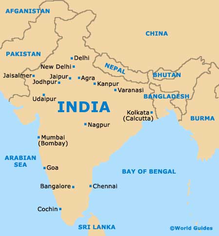
Map of India
Map of Jaisalmer