Swaziland Maps and Orientation
(Swaziland, SZ, Southern Africa)
Located on the far southern side of
Africa, between
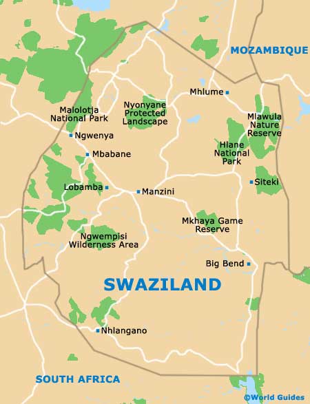
South Africa and
Mozambique, the Kingdom of Swaziland is occasionally referred to as either Swatini or Ngwane. Swaziland is located along a geological fault, running all the way from Lesotho's Drakensberg Mountains to Kenya's Great Rift Valley, passing through Zimbabwe's Eastern Highlands.
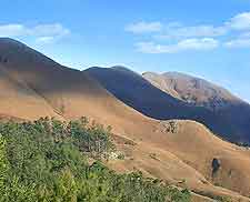
The country of Swaziland comprises a real assortment of landscapes, with mountains bordering Mozambique, lush rainforest within its north-westerly region, and easterly savannas. Lying alongside an escarpment, westerly Swaziland enjoys an elevated setting.
Maps and Orientation of the Country
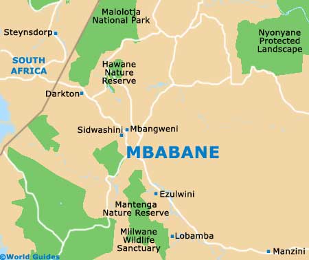
Mbabane, the capital city, resides within an especially scenic location, on the Highveld - which averages a 1,200-metre / 3,937-foot altitude. With a lower altitude, the Middleveld (roughly 700 metres / 2,297 feet above sea level) is the country's most densely populated area, while the Lowveld region has a considerably lower altitude of roughly 250 metres / 820 feet.
Apart from Mbabane, other notable towns and cities in Swaziland include:
- Big Bend - a characterful town known for its attractive surrounding scenery
- Hlatikulu - within the southerly Shiselweni district
- Lavumisa - a useful border-crossing point, next to Golela in South Africa
- Lobamba - regarded as the legislative and royal capital
- Mankayane - based within the Manzini district
- Manzini - an important business centre
- Mhlume - a small town in the Lubombo district, with many sugarcane fields
- Ngwenya - a westerly town lying close to the South African border town of Oshoek, near the Malolotja Nature Reserve
- Nhlangano - a good base for exploration
- Piggs Peak - situated close to the Phophonyane Waterfalls
- Siteki - an easterly town, based on the western side of the Lubombo (Lebombo) Mountains
Continent Map of Africa

Map of Swaziland
Map of Mbabane