Democratic Republic of the Congo Maps and Orientation
(Democratic Republic of the Congo - DRC, CD, Central Africa)
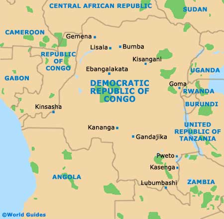
Also known as the Republique Democratique du Congo, the Democratic Republic of the Congo resides in Central
Africa, where it straddles the line of the equator, with around one-third being located to the north, and the remaining two-thirds to the south. This country is almost entirely landlocked and lies directly to the east of the similarly named country, the Republic of the Congo.
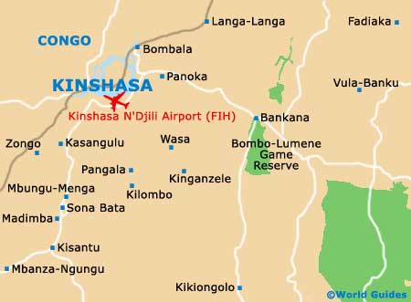
To the west, a very narrow area of land bisects the tip of Angola, alongside the Congo River, and borders the South Atlantic Ocean. The country itself is divided into a total of 25 separate provinces, with Kinshasa being the capital city. Significant Congalese ports and harbours include those of Banana, Boma, Bukavu, Bumba, Goma, Kalemie, Kindu, Kisangani, Kuba, Matadi and Mbandaka.
Maps and Orientation of the Country
The following countries surround the border as follows:
- Angola - south-west
- Burundi - east
- Central African Republic - north
- Republic of the Congo - west
- Rwanda - east
- Sudan - north-east
- Tanzania - east
- Uganda - east
- Zambia - south
Continent Map of Africa

Map of Democratic Republic of the Congo
Map of Kinshasa