Helena Maps and Orientation
(Helena, Montana - MT, USA)
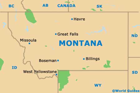
Located within the northerly state of Montana, the city of Helena serves as the state capital and also as the county seat for both Clark County and Lewis County. However, with a relatively small population of approximately 30,000 residents, this is actually only Montana's sixth-biggest city, after Billings, Missoula, Great Falls, Bozeman and Butte-Silver Bow.
The city resides on the southwestern side of Montana and is bisected by Interstate I-15 on its eastern axis. To the east of the I-15 is the Helena Regional Airport, while to the west lie the principal downtown attractions.
In the southwestern corner of the city's outskirts is Mount Helena Park, with its tall mountain overlooking the entire city and providing a very prominent backdrop.
Maps and Orientation of the City
If you are staying in downtown Helena, you will be able to walk to the main attractions with the help of a map, such as Lincoln Park, Lockey Park and the Montana State Capitol. The downtown district isn't especially well organized when it comes to its layout, although most avenues and streets either head north to south, or east to west.
Notable thoroughfares in central Helena include Broadway Street, 11th Avenue and Prospect Avenue, all of which run east to west, while North Montana Avenue heads in a northerly direction. If you are planning to drive all the way to Canada, then you will find the Canadian border roughly 200 miles / 322 km to the north.
- Anaconda - west
- Bannack State Park - south
- Belgrade - southeast
- Billings - east
- Bozeman - southeast
- Butte - south
- Dillon - south
- Great Falls - north
- Hamilton - west
- Livingston - southeast
- Marysville - northwest
- Missoula - west
- Philipsburg - west
- West Yellowstone - south
Map of USA
Map of Montana
Map of Helena
