Fort Myers Maps and Orientation
(Fort Myers, Florida - FL, USA)
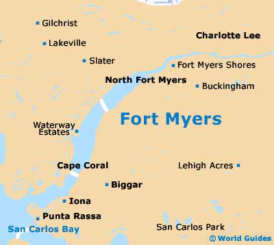
The administrative center and heart of Lee County, the city of Fort Myers is to be found on the southwestern coastline of Florida, being in the region of an hour's drive north of
Naples. Together with Cape Coral, Fort Myers belongs to the spreading Cape Coral-Fort Myers Metropolitan Statistical Area, which boasts a total population of approximately 650,000 people.
Located roughly 15 miles / 24 km to the south of the city itself, Fort Myers Beach is where much of the interest resides for holiday makers. The beach is quite a size and stretches for some 7 miles / 11 km along the barrier coastline of Estero Island, functioning as a popular suburb town. Close by, the Estero Bay Preserve State Park is a sizeable nature reserve and provides further interest, covering approximately 10,000 acres / 4,050 hectares and being a good place to spot Bald eagles.
Also nearby Fort Myers Beach is the Lovers Key State Park, which lies to the south, roughly in the direction of Bonita Springs, where it offers the chance to hike, kayak and explore.
Maps and Orientation of the City
The Fort Myers area is certainly spreading and therefore many visitors choosing to self-navigate find that maps are an essential item to carry around.
Maps can be obtained at the Greater Fort Myers Chamber of Commerce on Edwards Drive, which is situated within the Downtown Historic District and just down the road from the waterfront Fort Myers Yacht Basin, in between the Edison Bridge and the Caloosahatchee Bridge (Hancock Bridge). Alternatively, bookstores and gift shops selling maps can be found on streets such as College Parkway, Dynasty Drive, Fashion Drive, South Cleveland Avenue and the Tamiami Trail.
- Bonita Springs - 23 miles / 37 km (35 minutes, south)
- Cape Coral - 10 miles / 16 km (15 minutes, southwest)
- Charlotte Harbor - 27 miles / 43 km (45 minutes, northwest)
- Cypress Lake - 8 miles / 13 km (15 minutes, south)
- Englewood - 50 miles / 80 km (one hour and 20 minutes, northwest)
- Estero - 16 miles / 26 km (25 minutes, south)
- Immokalee - 35 miles / 56 km (55 minutes, southeast)
- Labelle - 30 miles / 48 km (50 minutes, east)
- Lehigh Acres - 18 miles / 29 km (30 minutes, east)
- Miami - 156 miles / 251 km (three hours, southeast)
- Naples - 42 miles / 68 km (one hour and five minutes, south)
- Orangetree - 41 miles / 66 km (one hour and five minutes, southeast)
- Pelican Bay - 30 miles / 48 km (50 minutes, south)
- Port Charlotte - 28 miles / 45 km (45 minutes, northwest)
- Punta Gorda - 24 miles / 39 km (40 minutes, northwest)
- San Carlos Park - 15 miles / 24 km (25 minutes, south)
- Tice - 5 miles / 8 km (12 minutes, east)
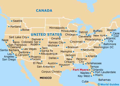
Map of the United States
Map of Florida

Map of Fort Myers