Lake Maracaibo / Lago de Maracaibo
(Maracaibo, Zulia, Venezuela)
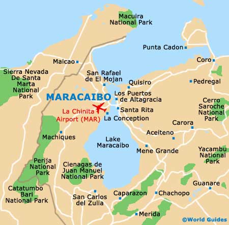
The Lago de Maracaibo is the most obvious landmark in this part of Zulia, measuring more than 13,000 square kilometres / 5,000 square miles. Although not strictly a lake (being somewhat open to the Gulf of Venezuela / Caribbean Sea), it is known as a lake rather than a bay and is a major shipping lane, linking both Maracaibo and Cabimas.
This brackish lake is fed by many rivers and features a series of islands (more than 450), such as the Isla de Pescadores, the Isla de Providencia, Los Pájaros, Maraca, Sabaneta de Montiel, San Bernardo, San Carlos, Toas and Zapara. Tours of the lake depart from the city, with fishing expeditions also being available. Of interest, the lake actually supports many thousands of local fishermen.
General Information
Connecting the city to the rest of the country is the Lake Maracaibo Bridge (General Rafael Urdaneta Bridge), a huge concrete structure that has stood at the lake's outlet since the early 1960s.
Renowned Venezuelan war hero General Rafael Urdaneta was responsible for the building of the bridge, which measures almost 9 km / 6 miles in length and is the world's largest concrete bridge, supported by many tall towers. The bridge is cable-stayed and worth crossing for its elevated views of the lake.
It is reputed that Lake Maracaibo is where the name 'Venezuela' originated, since its villages built on stilts reminded the Europeans of
Venice when they discovered it in 1499. They therefore named it 'Venezuela', being the Italian for 'Little Venice'.
Open hours: daily - 24 hours
Admission: toll charge for bridge, charge for tour of the lake