Antigua Maps and Orientation
(Antigua, Central Highlands, Guatemala)
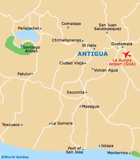
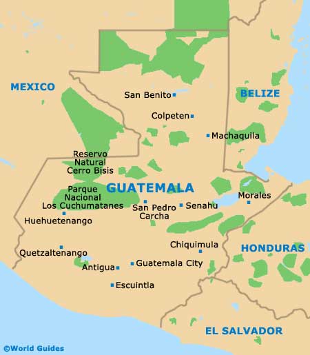
Antigua is a compact city in the central highlands region of
Guatemala, lying approximately 40 km / 25 miles to the south-west of the capital city,
Guatemala City. It is in the centre / west of the country, around 100 km / 62 miles from the coast on Guatemala maps, and is served by major highways from all directions.
There are various volcanoes and hills around Antigua to keep you oriented if you don't have regional maps to hand. The Water Volcano (Volcan Agua) is due south of the city, while to the south-west are the Acatenango and Fuego volcanoes, the latter of which has smoke coming from its peak. Cerro de la Cruz, meanwhile, is a popular landmark hilltop to the north.
Maps and Orientation of the City
The city proper is only a kilometre or so across and is mostly contained within a compact eight-by-eight block area, that is, eight blocks down and eight blocks wide. It can be crossed on foot in a few minutes, although it is best to use maps of Antigua to navigate, as there are little side streets going off here and there.
Despite being an old town, Antigua is systematically laid-out on a grid pattern. The aptly named
Central Park (Parque Central), also known as the Plaza Mayor, is at the core, while avenues (avenidas) go north to south and streets (calles) head east to west. Maps can be obtained from the Inguat Tourist Office on the Calle Oriente, or you may find that your hotel can furnish you with one. Antigua maps are also available from the numerous travel agencies based along the Avenida Norte and the Avenida Sur.
- Ciudad Vieja - 7 km / 4 miles (15 minutes, south-west)
- Escuintla - 38 km / 24 miles (30 minutes, south)
- Guatemala City - 40 km / 25 miles (45 minutes, north-east)
- Monterrico - 110 km / 68 miles (two hours, south)
- Pacaya Volcano - 40 km / 25 miles (one hour and 30 minutes, south-east)
- Quetzaltenango - 160 km / 99 miles (three hours and 15 minutes, north-west)
- Water Volcano (Volcan Agua) - 15 km / 9 miles (30 minutes, south)
Map of Guatemala
Map of Antigua