Thessaloniki Maps and Orientation
(Thessaloniki, Central Macedonia, Greece)
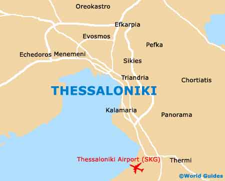
The second-biggest city in the whole of Greece and also the actual capital of the Macedonia area, Thessaloniki is home to a population soon set to exceed 400,000 people. Thessaloniki is located on the far north-easterly side of Greece, where it enjoys a coastal situation.
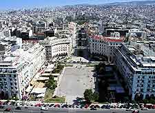
The city centre is edged on its southerly side by the seafront, while to the north, an imposing hill marks the boundary, next to Ano Poli (the Upper Town) and the ancient Byzantine Walls. Thessaloniki's Leoforos Nikis is a bustling waterfront street, which is overflowing with eateries and heads in an east-west direction, being sandwiched between the port and the landmark that is the White Tower (Lefkos Pyrgos).
Maps and Orientation of the City
A number of prominent streets run parallel to the seafront and above the Leoforos Nikis, such as the Mitropoleos, the Tsimiski, and the Egnatia, which is a prominent local artery. There are a number of central public squares within Thessaloniki and these include the Plateia Eleftherias alongside the port, and the Plateia Aristotelous, which is where many locals often choose to meet.
Thessaloniki is a large and spreading city, meaning that maps are always sensible. Brochures and maps relating to the city can be found at the tourist office, which is located within the passenger terminal at the port.
- Drimos - north
- Epanomi - south
- Korinos - south-west
- Lagadas - north
- Larissa - south
- Naoussa - west
- Sidirokastro - north
- Sindos - west
- Tirnavos - south
- Veria - west
Map of Greece

Map of Thessaloniki