Georgetown Maps and Orientation
(Georgetown, Penang, Malaysia)
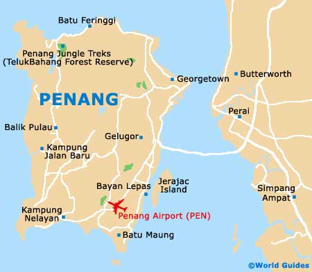
Georgetown lies along the north-eastern peninsula of Penang Island in roughly a triangular shape, with two of its sides jutting out into the Strait of
Malacca, giving it an extensive waterfront, port and beach area. The city's historic colonial core runs back from the peninsula's point and includes the commercial and trading centres. The urban area extends into the hinterland of the island and is connected with the Malaysian mainland by Penang Bridge, one of the longest in Asia. A second bridge has also recently been built to ease congestion.
Roads on the island are reasonably good, if sparse, and include the Jelutong Expressway linking Penang Bridge with Georgetown. The island has narrow coastal plains with hilly areas including Penang Hill in its centre. Most towns and villages lie on the coast or a short distance inland.
Maps and Orientation of the City
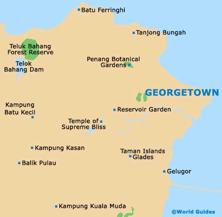
The Beach Road runs along the two sides of the peninsula, giving access to the city's port and to its many beaches. Immediately inland are the city's colonial core and most of its sites of interest, as well as shopping centres, accommodation and a number of embassies. The district is criss-crossed by small streets of old Chinese shophouses, protected from demolition as part of the city's heritage. Further back towards the edges of town are a handful of chain hotels.
Visitors who wish to explore Penang's interior often do so via guided tours, but for those who prefer to go it alone there are detailed maps available online, at car hire offices, and at Georgetown's tourist office (Tourism Malaysia), which is located to the east of the fort, on the Jalan Tun Syed Sheh Barakbah. Brochures including maps for the Penang Heritage Trail can also be found at the tourist office, and at the Penang Heritage Trust outlet on the Gat Lebuh Gereja.
- Balik Pulau - 25 km / 16 miles (30 minutes, south-west)
- Batu Ferrenggi - 13 km / 8 miles (15 minutes, north-west)
- Bayan Lepas - 15 km / 9 miles (20 minutes, south)
- Kampung Long Tambang - 29 km / 18 miles (25 minutes, south-west)
- Kampung Permatang Tengah - 25 km / 16 miles (30 minutes, south-west)
- Kampung Sungai Batu - 22 km / 14 miles (25 minutes, south)
- Penang Bridge - 18 km / 11 miles (20 minutes, north)
- Penang Hill - 7 km / 4 miles (15 minutes, south-west)
- Teluk Bahang Dam - 20 km / 12 miles (25 minutes, north-west)
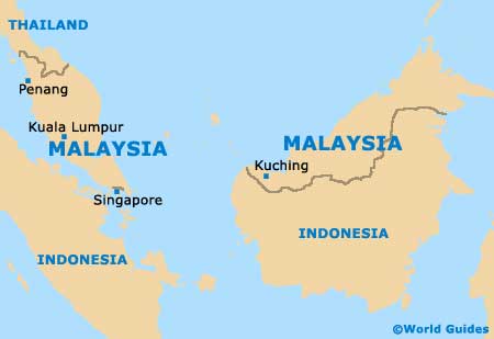
Map of Malaysia
Map of Penang
Map of Georgetown
More information about
Penang maps.
