Fukuoka Maps and Orientation
(Fukuoka, Kyushu, Japan)
Most people arriving on Japan's Kyushu Island will find that the northerly Fukuoka Prefecture will usually be their first point of call, a peninsula like setting surrounded on three sides by the sea. This is the case when driving by road, using the tunnel from Shimoneski, or flying into the busy Fukuoka Airport, Japan's third-biggest passenger airport used by around 20 million people each year.
The city of Kitakyushu is the most northerly location, although much of this area is fairly industrialised and the city of Fukuoka has far most tourist appeal. Around the Fukuoka Prefecture and off the northern coastline of Kyushu are a group of small islands.
Maps and Orientation of the City
Fukuoka city is the capital of this area and is situated to the north, alongside the Tsushima Strait. A densely populated city with a vast metropolitan area, bringing a map of the area is always a good idea. 'Visitors Walking Maps' of the main Hakata, Momochi, Nakasu and Tenjin districts are readily available around Fukuoka and completely free of charge.
The city of Fukuoka is surrounded by many areas of natural beauty, including mountainous regions and also the Sea of Genkai. Due to the city's constant expansion, many areas have now been constructed on reclaimed land and even man-made islands. Notable landmarks around the city include Fukuoka Tower, which measures more than 230 metres / 755 feet in height, and is famous for being the country's tallest seaside tower and dominates much of the coastline.
Fukuoka is one of Japan's closest cities to China, Korea and also Taiwan, which has resulted in especially close links and associations with these countries. Also close to Fukuoka are the following cities, towns and villages:
- Beppu - south-east
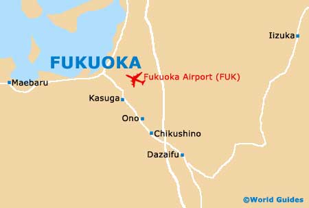
- Chikushino - south
- Fukuma - north
- Karatsu - south-west
- Kitakyushu - north-east
- Maebaru - west
- Nakama - north-east
- Nakatsu - east
- Oita - south-east
- Saga - south
- Shimonoseki - north
- Tagawa - east
- Tosu - south
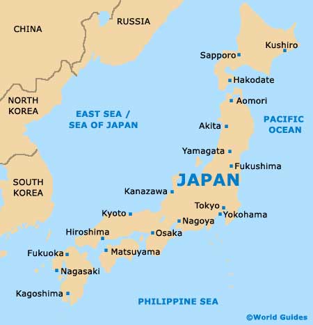
Map of Japan
Map of Fukuoka