Mozambique Maps and Orientation
(Mozambique, MZ, South-East Africa)
Located in South-Eastern
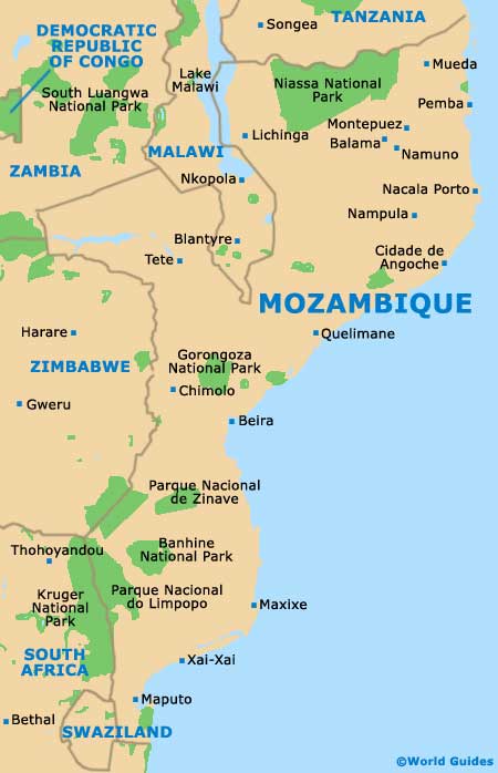
Africa, the Republic of Mozambique enjoys a lengthy coastline fronting the Indian Ocean, with this stretch of water known as the Mozambique Channel. The country lies directly to the south of Tanzania, to the east / south-east of
Malawi and
Lake Malawi, and to the east of Zimbabwe,
South Africa and
Swaziland.
Now boasting a population fast approaching 25 million, Mozambique is divided by the Zambezi River and comprises a series of highlands, lowlands, hills, plateaus, valleys and woodlands. Particularly important are the towns and cities of Beira, Bilene, Chimoio, Ibo, Inhambane, Lichinga, Maputo (the capital city), Nacala, Nampula, Pemba, Quelimane, Tete, Vilanculos and Xai-Xai.
Maps and Orientation of the Country
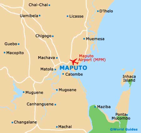
In Maputo, the Avenida 25 de Setembro is central to the action, although a better standard of accommodation awaits in the Sommerschield neighbourhood, roughly a 20-minute walk away. Easily located on maps and approximately 7 km / 4 miles from downtown Maputo are both Barrio Triunfo and Costa do Sol, with their appealing beachfront and good choice of eateries.
Popular with tourists is the connected island of Ilha de Mozambique, while other islands of importance are those of Bangue, Bazaruto, Benguerra, Magaruque and Santa Carolina, which together combine to make up the Bazaruto Archipelago. The coral reefs of Bazaruto are simply breathtaking and scuba diving is understandably a major pastime here.
- Botswana - west
- Lake Malawi - west / north-west
- Malawi - west / north-west
- South Africa - west / south-west
- Swaziland - west / south-west
- Tanzania - north
- Zambia - west / north-west
- Zimbabwe - west
Continent Map of Africa

Map of Mozambique
Map of Maputo