Varadero Maps and Orientation
(Varadero, Matanzas, Cuba)
At its widest point, the island of
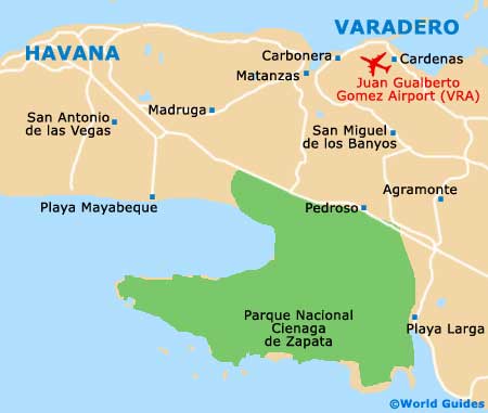
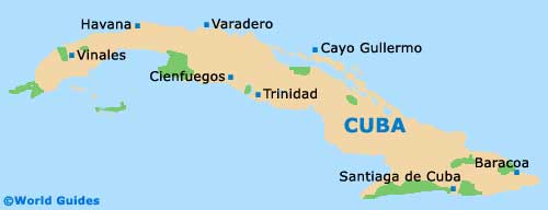
Cuba measures 200 km / 124 miles, with the northernmost region containing marshlands, swamps and many natural harbours. Varadero lies in the Matanzas province on the Hicacos Peninsula, a long, narrow strip of land jutting out towards the coastline of America. Its closest towns are Cardenas and Matanzas, with Cuba's capital,
Havana, some 140 km / 87 miles away to the west.
The coastal plain inland from the Hicacos Peninsula is marshy and low-lying, and contains several national parks, one of which is a UNESCO-listed wetlands reserve. Roads to Havana and major coastal cities are good but in general, public transportation is poor. Comprehensive maps are not easy to find in Cuba but are downloadable from the Internet.
Maps and Orientation of the City
At the western point of the peninsula where the Via Blanca ends, Varadero begins, with a bridge crossing a man-made channel between the bay and the Atlantic Ocean to the north. The main road becomes the Autopista Sur and traverses the narrow strip of land to Varadero's Marina Gaviota. Cuban communities are found in Bahia de Cardenas and Santa Marta, with the main tourist town beginning at Calle (district) 13 and running west to east along the beaches.
The eastern end of town contains the most upmarket hotels and facilities. Visitors with weak chests should avoid the western end of town, as nearby oil wells release sulphurous gas and this is known to drift over this district. Maps of Varadero can be found at hotel front desks and at the tourist centres, such as Havanatur on Calle 33, and Infotur on Calle 13.
- Bay of Pigs - 139 km / 87 miles (two hours and 30 minutes, south-east)
- Cardenas - 20 km / 12 miles (20 minutes, south-east)
- Cienfuegos - 192 km / 120 miles (two hours and 15 minutes, south)
- Havana - 140 km / 87 miles (two hours, west)
- La Boca - 94 km / 58 miles (one hour and 45 minutes, south-east)
- Matanzas - 50 km / 31 miles (45 minutes, north-west)
- Pinar del Rio - 309 km / 193 miles (five hours, west)
- Sancti Spiritus - 285 km / 178 miles (four hours and 45 minutes, south-east)
- Santa Clara - 199 km / 124 miles (two hours and 15 minutes, south-east)
- San Miguel de los Banyos - 40 km / 25 miles (40 minutes, south)
- Trinidad - 262 km / 163 miles (four hours, south-east)
Map of Cuba
Map of Varadero