Cartago Maps and Orientation
(Cartago, Costa Rica)
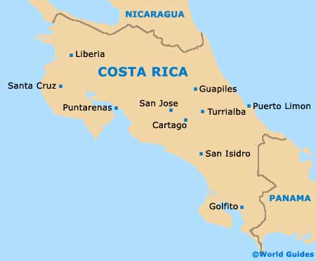
Cartago lies in the province of the same name, smack bang in the centre of
Costa Rica, just over 20 km / 12 miles to the south-east of the capital San Jose. This former Costa Rican capital is a sizeable city, although, when compared with San Jose on maps, it is dwarfed by the current capital.
The city is about 5 km / 3 miles across and the same deep, although the downtown area, where the main attractions and facilities are based, is a kilometre square. Cartago is served by the Pan-American Highway, which comes down from San Jose to join with Highway 10, providing reliable access from Paraiso.
Maps and Orientation of the City
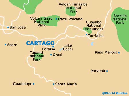
Inner Cartago is laid out on a grid system in the downtown area and is easy to negotiate, with avenues (avenidas) going east to west and streets (calles) heading north to south. The junction of Avenida 1 and Calle 1 is officially the city centre. Noted structures are at this point, with the bus and train stations off to the north and the main sight of the Basilica of our Lady of the Angels (Basilica de Nuestra Senora de los Angeles) to the east.
It is best to pick up Cartago maps to avoid getting lost and you can order them online before you travel. You can also find local maps from the Savegre Mountain Hotel, within the south-easterly San Gerardo de Dota suburb, as well as from the Juan Santamaria International Airport (SJO) in San Jose. It is worth picking up a city map, along with a Cartago Provincial map, to detail routes out to nearby towns. Of note, there is no tourist office located in the city at present.
- Cachi Dam - 20 km / 12 miles (30 minutes, east)
- Irazu Volcano - 20 km / 12 miles (45 minutes, north)
- Orosi / Orosi Valley - 15 km / 9 miles (25 minutes, south-east)
- Paraiso - 6 km / 4 miles (ten minutes, south-east)
- San Jose - 22 km / 14 miles (30 minutes, north-west)
- Tapanti National Park - 18 km / 11 miles (45 minutes, south)
- Turrialba - 40 km / 25 miles (45 minutes, north-east)
Map of Costa Rica
Map of Cartago