St. Petersburg Maps and Orientation
(St. Petersburg, North-Western Federal District, Russia)
Established at the very beginning of the 18th century, St. Petersburg was once the historic Russian capital city and is the second-biggest city in the Russia Federation. St. Petersburg is situated within the north-western Federal District and grew up around the Neva River, which is today lined by many beautiful buildings, such as St. Isaac's Cathedral and its spectacular golden dome.
The Neva River lies at the far eastern side of the Baltic Sea and the Gulf of Finland, and has been directly responsible for much of the cities wealth and status. Flowing in a northerly and westerly direction, the Neva crosses the very heart of St. Petersburg, before it forms a series of smaller waterways around the Delta islands.
Maps and Orientation of the City
Central St. Petersburg is based next to the Winter Palace, on the southern bank of the Neva River, alongside the Admiralty building, which dominates the area with its tall spire and is amongst the city's oldest structures. Nearby, the Nevsky Prospekt is one of the most famous streets in the whole of Russia and is flanked with many cultural attractions, restaurants and shopping opportunities.
On the northern side of St. Petersburg, the city is made up of three distinct areas. These are the central Petrograd, the westerly Vasilyevsky Island and the easterly Vyborg.
- Gatchinskiy Rayon - south
- Kirovskiy - south-west
- Kolpino - south-east
- Krasnoe Selo - south-west
- Moscovskiy - south
- Puskin - south
- Shushary - south
- Siverskij - south
- Sosnovo - north
- Staropanovo - south-west
- Tosnenskiy Rayon - south-east
- Vasileostrovkiy - west
- Verkhnie Osel'ki - north
- Vsevolozhskiy Rayon - north-east
- Zaporozskoe - north
Map of Russia

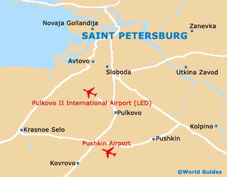
Map of St. Petersburg