Galway Maps and Orientation
(Galway, County Galway, Republic of Ireland)
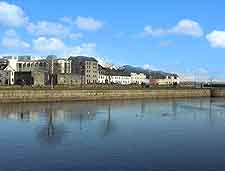
The centre of Galway is sandwiched between the River Corrib, Lough Atalier and the harbour, with parts of the centre standing right on the quayside, facing out towards the large Galway Bay. There is a small pedestrianised centre which is easily navigable on foot, and many of the city sights are centrally located here. A stroll along the Corrib river banks is also a pretty experience.
Market Street is the main commercial thoroughfare and runs adjacent to the older part of town, while the Corrib Shopping Centre, near Eyre Square and Kennedy Park, is a more popular commercial district. Both are within a few minutes walk of each other and this area is host to numerous pubs and restaurants.
Maps and Orientation of the City
Visitors will find that many of the B&Bs are located in Salthill to the west of the city, across the river, with the airport being sited on the east side of Galway. The city stretches out alongside the shoreline of the bay, although the waterfront isn't always accessible.
Galway is an excellent launch pad for exploring the nearby scenery, including such tourist favourites as Connemara - which is easily visited in a day trip, Menlough / Lough of Corrib - which attracts fishing enthusiasts, and the stark Burren to the south. Even the dramatic Cliffs of Moher can be seen in a day trip from Galway.
- Ballinasloe - 45 km / 28 miles (40 minutes, east)
- Ballyvaughan - 24 km / 15 miles (25 minutes, north-west)
- Connemara - 60 km / 37 miles (50 minutes, north-west)
- Ennis - 45 km / 28 miles (40 minutes, south-east)
- Gort - 25 km / 15 miles (20 minutes, south)
- Kinvara - 10 km / 6 miles (15 minutes, south)
- Loughrea - 37 km / 23 miles (35 minutes, south-east)
- Tuam - 20 km / 13 miles (20 minutes, north-east)
Map of the United Kingdom

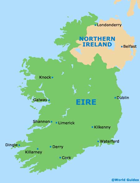
Map of Ireland
Map of Galway

