Kota Kinabalu Maps and Orientation
(Kota Kinabalu, Sabah, Malaysia)
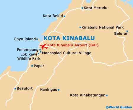
Kota Kinabalu is on the west coast of Sabah, which translates as north-west Borneo. It is a large city (for Borneo), stretching several kilometres in either direction from the shoreline. The downtown area is a busy hub and resides in a relatively compact spot near to the harbourfront.
Maps of Kota Kinabalu are best obtained even if you plan on just sticking to the city centre and main attractions. You can pick up Kota Kinabalu maps online or from the Sabah Tourism Board at 51 Gaya Street (Jalan Gaya).
Maps and Orientation of the City
It is easy enough to get around Kota Kinabalu on foot, as most of the hotels and attractions are right in the city centre, in and around the several blocks that occupy the waterfront area.
The airport is just a few kilometres to the south of the city centre, while due west is the Tunku Abdul Rahman Park and its many islands. The Sabah Fish Market, hotels, mosques and attractions are just south of the ferry terminal.
- Beaufort - 93 km / 58 miles (one hour and 45 minutes, south-west)
- Kota Belud - 76 km / 47 miles (one hour and 20 minutes, north-east)
- Kota Kinabalu City Bird Sanctuary - 3 km / 2 miles (ten minutes, north-east)
- Kudat - 160 km / 100 miles (two hours and 45 minutes, north-east)
- Lok Kawi Wildlife Park - 11 km / 7 miles (20 minutes, south)
- Monsopiad Cultural Village - 13 km / 8 miles (20 minutes, south)
- Mount Kinabalu National Park - 85 km / 53 miles (two hours, north-east)
- Papar - 38 km / 24 miles (55 minutes, south-west)
- Penampang - 15 km / 9 miles (30 minutes, south-east)
- Sandakan - 325 km / 202 miles (five hours and ten minutes, east)
- Tenom - 196 km / 122 miles (three hours, south)
- Tuaran - 33 km / 21 miles (40 minutes, north-east)
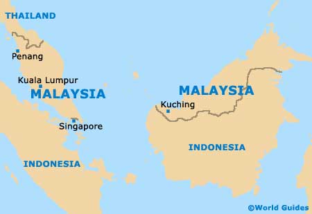
Map of Malaysia
Map of Kota Kinabalu