Chennai Maps and Orientation
(Chennai, Tamil Nadu, India)
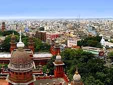
Chennai is a big city (India's fourth-largest), and it bleeds into several districts and suburbs. For tourism purposes, most of the action takes place in the central districts, though there are some significant attractions to the south which may require commuting through some of the smaller southern communities. In any event, maps are an excellent investment if you plan on venturing more than a few steps outside your hotel.
Chennai sits on the Bay of Bengal and extends haphazardly to the west. The Anna Salai Road runs north to south through the city and links all of its major districts. It changes names a few times along the way, and it's variously known as Mount Road and GST Road in the interim. The long expanse of Marina Beach fronts the most commercialised district, where you will encounter the majority of the tourist infrastructure.
Maps and Orientation of the City
Central Chennai is, of course, the epicentre of the city, but there is also some commercial buzz to the north. Neighbourhoods in this area include Pozhal, Enmore, Purasavakkam and Perambur, each with its own selection of shops, restaurants and hangouts.
South and west of Chennai city centre are heavy concentrations of residential neighbourhoods. While the area to the west is almost strictly residential, the area to the south does have a few amusement parks that have paved the way for family hotels and a better spread of shops and restaurants. Your hotel's front desk will be able to advise you on where to pick up a quality map if required.
- Adayalampattu - 13 km / 8 miles (20 minutes, west)
- Bengaluru - 350 km / 220 miles (five hours and 30 minutes, west)
- Chinna Nolambur - 12 km / 7 miles (18 minutes, west)
- Crocodile Bank - 41 km / 25 miles (50 minutes, south)
- Gingee (Senji) - 149 km / 93 miles (two hours and 55 minutes, south-west)
- Kanchipuram - 82 km / 51 miles (one hour and 35 minutes, south-west)
- Kishkinta - 33 km / 21 miles (50 minutes, south-west)
- MGM Dizzee World - 31 km / 19 miles (45 minutes, south)
- Mamallapuram - 70 km / 43 miles (one hour and 20 minutes, south)
- Nanmangalam Reserved Forest - 21 km / 13 miles (30 minutes, south)
- Pallikaranai Marsh Reserve Forest - 17 km / 11 miles (25 minutes, south)
- Perambur - 10 km / 6 miles (15 minutes, north)
- Vellore - 145 km / 90 miles (two hours and 40 minutes, west)
- VGP Golden Beach - 20 km / 12 miles (30 minutes, south)
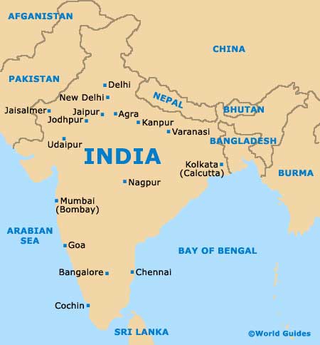
Map of India
Map of Chennai

