Milwaukee Maps and Orientation
(Milwaukee, Wisconsin - WI, USA)
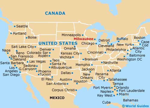
The city of Milwaukee is to be found on the southeastern side of Wisconsin, being roughly 39 miles / 63 km to the north of Kenosha, and a little more than 90 miles / 145 km north of
Chicago,
Illinois.
The expansive waterfront of Lake Michigan is the big attraction here, with its plentiful parks and scenic paths. These lead along either side of the Milwaukee River and link the downtown district.
Various busy roads connect outlying destinations around the city. The I-794 Interstate heads southwards to the General Mitchell International Airport, while the I-94 runs westwards to West Allis, Wauwatosa, Rocky Point and Delafield. The I-94 connects with the I-894 Interstate (Zoo Freeway), which leads to the I-43 (Rock Freeway) and to the southwest, passing by Mukwonago, East Troy, Elkhorn and Delavan, before reaching Beloit.
Maps and Orientation of the City
Much of the interest for visitors lies within downtown Milwaukee, such as East Town, Kilbourn Town and the Historic Third Ward, as well as the Lakeshore State Park and the Henry W. Maier Festival Park. Maps from the Milwaukee Convention and Visitors Bureau are always useful, with this tourist outlet being found on West Wisconsin Avenue and within the Frontier Airlines Center, just minutes away from the Milwaukee Public Library.
Many hotels stand in this part of the city, such as the Best Western Inn, the Doubletree, the Hilton and the Hyatt Regency. Notable attractions in downtown Milwaukee include the likes of the Humphrey IMAX Dome Theater, MacArthur Square, the indoor US Cellular Arena and the Milwaukee Theater.
- Brookfield - 12 miles / 19 km (20 minutes, west)
- Caledonia - 19 miles / 31 km (30 minutes, south)
- Coldwater Creek - 24 miles / 39 km (40 minutes, northwest)
- Glendale - 9 miles / 14 km (15 minutes, north)
- Greenfield - 11 miles / 18 km (20 minutes, southwest)
- Hales Heights - 15 miles / 24 km (25 minutes, southwest)
- Mequon - 18 miles / 29 km (30 minutes, north)
- Morgandale - 5 miles / 8 km (12 minutes, southwest)
- Muskego - 18 miles / 29 km (30 minutes, southwest)
- Shorewood - 5 miles / 8 km (12 minutes, north)
- South Milwaukee - 11 miles / 18 km (20 minutes, south)
- Waukesha - 18 miles / 29 km (30 minutes, west)
- Wauwatosa - 6 miles / 10 km (12 minutes, west)
- West Allis - 7 miles / 11 km (15 minutes, west)
- Whitefish Bay - 8 miles / 13 km (15 minutes, north)
Map of the United States
Map of Wisconsin

Map of Milwaukee

