Santa Monica Maps and Orientation
(Santa Monica, California - CA, USA)
An appealing seaside city located in southern California, the popularity of Santa Monica is certainly greatly influenced by its extreme proximity to
Los Angeles and its reliably sunny weather. However, during the late spring / early summer, a heavy morning fog is not uncommon.
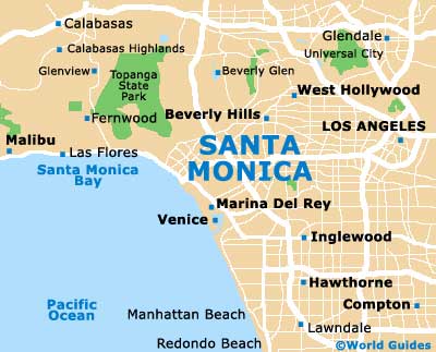
This small city lies alongside Santa Monica Bay and on the western side of Los Angeles County, where it is favored by both holiday makers and celebrities from nearby Hollywood. Santa Monica sits on a relatively flat gentle slope, which is angled towards the busy thoroughfare of Ocean Avenue.
Venice Beach is especially close to Santa Monica, being roughly ten minutes away and to the southeast. Slightly further afield, Malibu Beach is around 35 minutes to the west, while
Long Beach is a similar distance away, to the southeast. By car, downtown Los Angeles is reachable in 25 minutes or thereabouts, via Interstate I-10 (Santa Monica Freeway), passing by Culver City and the LA suburb of Mid City.
Maps and Orientation of the City
In the center of Santa Monica, a series of numbered roads head northwest to southeast, being intersected by named avenues to create an organized layout of city blocks.
Maps clearly show this structure and its good connections to the rest of California, thanks to Interstate I-405 (Nathan Shapell Memorial Highway), which heads northwards all the way to Mission Hills and San Fernando, and southwards to Hawthorne, Carson and Long Beach.
- Anaheim - 40 miles / 64 km (one hour, southeast)
- Burbank - 26 miles / 42 km (40 minutes, northeast)
- Downey - 27 miles / 43 km (40 minutes, southeast)
- Glendale - 22 miles / 35 km (35 minutes, northeast)
- Hawthorne - 14 miles / 23 km (20 minutes, southeast)
- Inglewood - 11 miles / 18 km (15 minutes, southeast)
- Los Angeles - 16 miles / 26 km (25 minutes, east)
- Malibu - 22 miles / 35 km (35 minutes, west)
- Oxnard - 58 miles / 93 km (one hour and 20 minutes, west)
- Palm Springs - 121 miles / 195 km (three hours, east)
- Rancho Palos Verdes - 36 miles / 58 km (55 minutes, southeast)
- Redondo Beach - 19 miles / 31 km (30 minutes, southeast)
- San Diego - 134 miles / 216 km (three hours and 15 minutes, southeast)
- Santa Barbara - 92 miles / 148 km (two hours and 15 minutes, west)
- Santa Clarita - 32 miles / 51 km (45 minutes, north)
- Torrance - 20 miles / 32 km (30 minutes, southeast)
- West Covina - 35 miles / 56 km (50 minutes, east)
- West Hollywood - 11 miles / 18 km (15 minutes, northeast)
Map of the United States
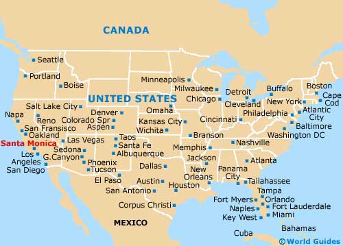
Map of California

Map of Santa Monica