Vila do Porto Maps and Orientation
(Vila do Porto, Azores, Portugal)
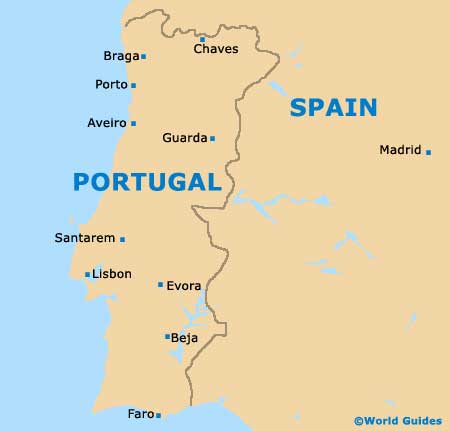
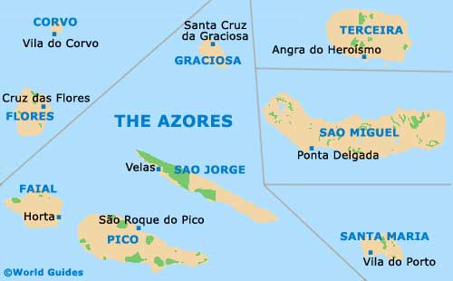
A little over 1,450 km / 900 miles west of mainland Portugal, Santa Maria is the oldest island in the volcanic Azores archipelago. It is the south-east anchor of the chain of islands and has some of the best sandy beaches in the Azores. The rock formations on Santa Maria are also remarkable, including limestone chimneys and sandstone fossil deposits.
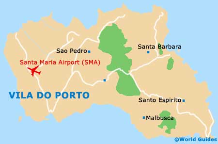
Vila Do Porto is on the south-west shore of the island along the EN 1-2 motorway. This popular resort town operates the most important marina on the island and regularly receives ferries from Sao Miguel and several other islands in the chain. Tourists can pick up maps in Vila Do Porto to simplify exploration of the entire island.
Maps and Orientation of the Town
The EN 1-2 motorway follows the southern shore of Santa Maria and connects to Santo Espirito, another town with a strong historic character. Smaller secondary roads access the interior and link towns such as Santa Barbara and Sao Pedro. While buses connect to most towns on the island, a hired car is much more practical for tourists.
If you do decide to hire a car, you will want to pick up a map either from the hire car firm or your hotel's front desk. Shops and newsstands in Vila Do Porto also make detailed maps available to tourists. By the same token, a map of the island is essential for planning walking tours of the churches around Santa Barbara.
- Almagreira - 7 km / 5 miles (ten minutes, east)
- Anjos - 7 km / 5 miles (ten minutes, north)
- Praia Formosa - 10 km / 6 miles (15 minutes, south-east)
- Santa Barbara - 11 km / 7 miles (20 minutes, north-east)
- Santo Espirito - 21 km / 13 miles (30 minutes, east)
- Sao Lourenco Bay - 13 km / 8 miles (25 minutes, north-east)
- Sao Pedro - 7 km / 5 miles (ten minutes, north-east)
Map of Portugal
Map of the Azores
Map of Santa Maria Island

Map of Vila Do Porto